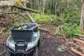
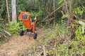
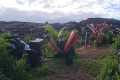
HAWAIʻI ISLAND - Over a thousand government video files, recorded by Unoccupied Aircraft Systems between May and September 2018 during the four-month eruption of Kilauea volcano on the lower East Rift Zone... have been released by the U.S. Geologcal Survey. Most of it has never before been seen by the public.
This is our first video in a series exploring this newly available footage. The federal Data Release contains videos that were used by emergency officials for monitoring the lava flows that destroyed 723 structures, inundated 13.7 square miles of land, and created 875 acres of new land along the Puna shoreline.
A synthesized voice was utilized in the narration for this story. Video and photos are from the USGS Hawaiian Volcano Observatory.